Plymouth Historical Society
572 Main Street
Plymouth, CT 06782
Website: www.plymouthhistoricalsociety.org
Town Historian, writer, and researcher Judith Giguere, life-time Terryville resident, writes articles for this web site about Plymouth's history during different time periods. Articles are posted as submitted below. Many thanks to her for presenting these special articles. All photos were taken by Judith Giguere unless otherwise indicated.
Dedication Celebration of the Plymouth Civil War Monument
By Judy Giguere
Plymouth Town Historian
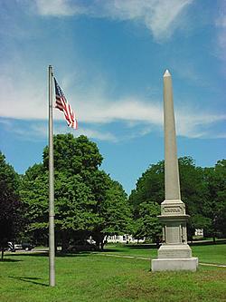 The year was 1870 and the 2nd Connecticut Heavy Artillery assembled at Plymouth Green on the 7th of September. The Lincoln Monument on the Plymouth Green
event was a reunion of the unit and their presence at the dedication of the brand-new Civil War monument on Plymouth Green.
In December, 1865, Bela Satterlee had called for the inhabitants of Plymouth to honor Plymouth sons, uncles, fathers and brothers that served in the Civil War and the many that were lost. His plea was to build a monument for the remembrance of those that answered Mr. Lincoln’s call for 300,000 soldiers in defense of the Union. The unit served in such battles as Spotsylvania, Cold Harbor, Cedar Creek and numerous others. Many were lost in battle and were taken prisoner, and others succumbed to disease, hunger, and their wounds. A monument had already been erected at Hillside Cemetery in Terryville, so this one would be for the Plymouth Green.
Mr. Satterlee’s request was successful. One thousand three hundred dollars was raised to erect a beautiful monument on the Plymouth Green. The monument was made of Quincy granite provided by the Plymouth Granite Company. It is 22 feet one inch high, one foot for each of the 22 names inscribed on it. The base is four-feet seven-inches square and inscribed with the words: “Erected to perpetuate the memory of those who lost their lived in the war of 1861” and the name “Lincoln.” Cannons are carved on the sides and the names of the 22 dead are inscribed on the four sides.
| North side: | South side: | East side: | West Side: |
|---|---|---|---|
| David Davenport Benjamin Filley Frederick L. Grant Ira Hough E. L. Lane Daniel Matthews Thomas Mann John Murphy |
Chaplin James Averill Lt. F. J. Candee Lt. H. Hubbard Sgt. W. A. Bishop Sgt. H. T. Bishop Sgt. D. B. Wooster Cpl. J. B. Green Cpl S. B. Smith |
John Allen Philo Andrews George W. Andrus George H. Baker George L. Beach E. C. Blakeslee Almon Blakeslee George H. Brooks Henry A. Brooks Hiram T. Cooley |
Eben Norton William Platt Jas. Straun Legrand Todd Josiah J. Wadsworth Charles R. Warner William Wright Edward R. Weed Charles Williams Miner C. Wedge |
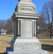 The monument was only completed a day or two before the ceremony. The men and women of the town gathered on the Green to hear speeches and prayers by such locals as Rev. J.W. Backus of Thomaston, Rev. Porter Thomas, and Rev. H. B. Hillard, pastor of the Plymouth Congregational Church that overlooks the monument. The monument was decorated with evergreens and flowers.
After the dedication of the Plymouth monument, the regiment and guests moved on to ceremonies to dedicate the Civil War monument in the center of the neighboring town of Thomaston.
Source: Hartford Courant September 8, 1870.
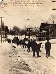 The years of 1550 to about 1750 were called “The Little Ice Age, caused by cooling of the earth’s temperatures. Collective
record keeping didn’t begin until much later, but early settlers frequently kept diaries to tell the tale of the harshness of New England winters. By 1820, reports of weather conditions were sent to the Smithsonian Institute. The reports could be disseminated to the public through newspapers and telegraph.
An early notable storm was the Great Snow of 1717. It was preceded by very mild temperatures up to mid-February. Some settlers even began planting beans and other early crops. The Great Snow deposited between five and ten feet of snow through a series of close storms. Severe cold began the winter of 1740-1741 followed by two weeks of rain causing major flooding. Other record years were 1786, 1821 and 1855-1856 when the Connecticut River remained frozen into April.
Stories of the Blizzard of 1888 are not exaggerated. It arrived in early March with artic temperatures, high winds and heavy snow along the East Coast. More than two hundred ships sunk and over one hundred seamen perished as well. Cheshire recorded a snow drift of thirty-eight feet!
Travel and commerce have always been impacted by snows. Early transportation was on foot, horse, or wagon. Wagons could be fitted with runners to glide over the snows. Sleigh rides were very popular. Snow removal was another matter, however. Early snow removal involved city/town dwellers shoveling snow to level the drifts for sleigh travel. In the 1840s, the first patents were issued for snow plows but the idea did not catch on until much later. Horse-drawn plows were first attached to carts, and later plows were attached to steam trains and eventually trucks. Attempts were made to put plows on electric trolley cars, but it was unsuccessful. Salt was used in a few cities but residents complained the salt damaged their clothing and also created unfavorable conditions for sleighing.
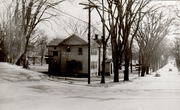 It wasn’t long before residents and merchants complained that snow inhibited commerce and snow removal became a municipal problem. Initially, snow removal meant removing snow from the road, but not the sidewalks. Residents were required to clear their own sidewalks and store owners bemoaned the huge piles obstructing store fronts. Crews were hired to remove snow piles and snow loaded onto carts to be moved to other locations. Plymouth and Terryville were no exception. In the 1920’s, the town continued to hire crews to remove snow and clear the roads. Eventually, motorized equipment followed for clearing of the roads.
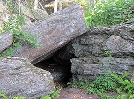 The name has been so often repeated as to become clique. There was a time when it really had meaning, when it was an active place, not just the stuff of myth, ghost stories and legends. It was in the early days of our nation, when some, known as “Tories”, were still loyal to England, yet others were anxious to form a new, independent nation.
Captain John Wilson was a natural leader and the leader of the Harwinton band of the Sons of Liberty. The Sons of Liberty patrolled the vicinity and those with any inkling of loyalty to Great Britain were favorite targets. Captain Wilson is described in many accounts as “dreadful full of zeal” for the American cause, much to the woe of the Tories. The women of the Tory families were the watchers as their sons, brothers, uncles and husbands worked the fields. When Captain Wilson and the Sons were about, an alarm was sounded by the tin horn of Mrs. Ebenezer Johnson or the conch shell of Mrs. Steven Graves. The menfolk quickly scurried to the Tory Den or other hiding places in the dense woods.
The Tory Den was well hidden among the Ledges of the Old Marsh region. Imagine how dense the foliage and trees were over 240 years ago! The Tory Den remained hidden and mysterious until the 1830’s, long after the Revolutionary War, partially due to the density of the woods as well as the lack of settlement in the area. The Glacial Age left many rock formations. One of these rock formations created the Tory Den. It is basically large rocks leaning against each other forming a hollow beneath. The gap beneath the stones was large enough for two lines of seven men to sit facing each other in the stillness of the wilderness waiting for the “storm” to pass. I asked how so many could fit within the Den and was reminded that much mud and earth has filled in the space over the passing of time as well as a wry comment that people were much smaller then. Whatever the reason, it is remains a local legend.
Some say it’s haunted by those that spent many nights in hiding. Their spirits unable to move on or possibly still protecting their farms and families. Legends tell of Tory gold that may have been hidden there. In reality, no one on either side was wealthy. Fear and real danger existed, instead of hiding their treasure wouldn’t they would have used it to protect themselves or further the cause they believed in? Joel Tuttle escaped a near tragedy and hid in the Den until it was safe to go back home. Daniel Tuttle was openly loyal to England. His lands, homestead and property were confiscated and sold at auction. Moses Dunbar another Loyalist, executed for treason in 1977, no doubt spent many nights hiding from Captain Wilson and the very active Sons of Liberty.
Plymouth has a very definite history in the early beginnings of this nation, on both sides of the issue. Tempers were short and ideals strong. There are many stories, legends and history in our town. This is the first in a series of Plymouth History focusing on Plymouth’s contributions in the Revolutionary War.
By Judy Giguere, Plymouth Town Historian
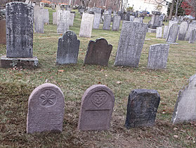 January, 2014 - Mortality was an ever present issue for the early settlers of Northbury. Diseases like Diphtheria, Smallpox, Measles, and Consumption (Tuberculosis) were all too common and the vaccines and antibiotics we have today didn’t exist in early times. In the Old Plymouth Burying Ground, of approximately 600 recorded graves dating from 1740 to 1870; 102 graves were that of children under the age of 5 years. The infant mortality was so great, names were often re-used, making research of families very difficult. Women frequently died in childbirth, or the consequences of childbirth. The statistics of female deaths for the ages of 18-45 were about 98, yet in comparison, male deaths in the same category, which included soldiers, only 58. In spite of these statistics, longevity for both men and women of early Northbury was quite high. The numbers of those living to age 60 or more totaled 218. It is the frequency of child and female mortality that give the appearance of a short life span for early settlers.
Reverend Samuel Todd was the first minister to Northbury and married, Mercy, the daughter of Reverend Peter Evans of Northfield, Massachusetts on August 31, 1739. Reverend Todd graduated from Yale College in 1734 was ordained May 7, 1740, as the first minister of the Northbury Parish (Northbury later became Plymouth). Due to changes in church doctrine and religious philosophies Reverend Todd was dismissed in August 1764 and the Todd’s left Northbury. He and his family settled in Adams, Massachusetts, near their daughter Alathea who had married Deacon Israel Jones, Jr. Reverend Todd organized a Church there of which he was pastor until 1776. He served for a brief time as a Chaplin in the Continental Army. The Todds moved to Orford, New Hampshire about 1782. Reverend Todd died June 10, 1789. Mrs. Todd seems to have disappeared off the records. It is believed that Reverend Todd took his original records with him when he left Northbury. So far, the original records have not been found leaving, The Old Plymouth Burying Ground with many unmarked and at present, unconfirmed graves.
Reverend Samuel Todd’s family was no exception to the early death statistics. According to the newly found gravestone, Lucy the daughter of Reverend and Mrs. Todd died in 1752 at 11 months old. An earlier loss was discovered in researching the Todd family. Little Alathea was born December 7, 1740 and drowned in a spring located on Reverend Todd’s Town Hill property which is in the vicinity of Terryville Fairgrounds. It is speculated by the Francis Atwater in his History of Plymouth published 1895 that Alathea is buried next to Lucy. Reverend E. B. Hillard, a later minister to Plymouth (1869-1889), also speculated that the unmarked grave next to Lucy was that of little Alathea. Another child named Lucy, a twin to Chloe, was born August 7, 1756 and died January 9, 1757. It is assumed that she buried next to her sisters.
Other members of the Todd family also settled, lived and died here. Hannah Tuttle married Reverend Samuel’s brother Edmond. The couple made their home in Todd Hollow. Oliver Todd, the uncle of Reverend Todd, married Abigail Warner and settled in Northbury. Reverend Todd’s sister, Susannah, married Caleb Humaston and also made their home in Northbury. Oliver and Abigail Todd’s daughter, Miranda was two years old when she died and is buried in the Old Plymouth Burying Ground. Families came, worked, succeeded and some failed, but they came and contributed to making Plymouth a town worthy of recognition. Ambitious, ingenious individuals such as Eli Terry and members of the Terry family as well as Silas Hoadley, the Sheltons and others settled and built homes and thriving industries. The immigrants to the new United States, worked in their factories and made their place and their contributions in Plymouth as well. Their successes are recorded in Plymouth history, their losses, their mortality, and their heartbreaks, recorded in our graveyards.
By Judith Giguere, Town Historian
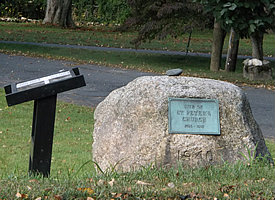
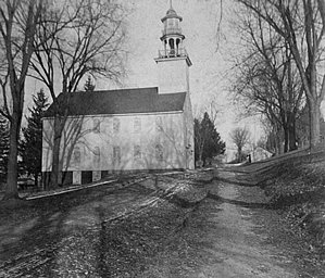 October, 2013 - At the northeastern corner of Plymouth Green lies a monument in remembrance of the early years of St. Peter’s Church which once stood on that site. The Episcopal Church, a branch of the Church of England, was established during the infancy of Plymouth, then known as “Northbury,” The year was 1740. The St. Peter’s Church was organized by eleven families that broke away from Reverend Samuel Todd’s early Congregational Church of eighteen families. The separation came partially over a dispute about the location of the Church and partially over doctrine. The families located below “The Hill” wanted the Church to be built in the vicinity of Thomaston center, yet families living easterly wanted the Church to be located at the top of the hill. The great difficulty was the necessity of travelling through numerous fields, gates to be opened and closed, streams to be forded and crossing of the “Great River” as the Naugatuck River was then called. A cart bridge was not built until 1747. Travel was lengthy, precarious at best and often dangerous in times of heaving rains and flooding.
 Other difficulties arose as many missed the Church of England with holiday celebrations, puddings with raisins, Christmas Trees with candles and gifts for the children, the holiday yule log celebration with songs and stories as well as the familiar rituals which were not part of the Congregational Church. St. Peter’s Parish built a little church near the center of Thomaston, until it became too small. St. Peter’s Parish experienced the difficulties during the time of the Revolutionary War when everything and anything even remotely English was determined to be treasonous. Its members were considered to be much under the influence of Rev. James Nichols, an ardent loyalist, who swayed membership in favor of England. Tensions ran high. Rev. Nichols was captured by local Sons of Liberty and tarred and feathered. Rev. Nichols was tried for treason in Hartford Superior Court in January 1777 but acquitted, after which he went into hiding. Later, broken by his experiences during Revolutionary War times, he retreated to Arlington, Vermont was installed as a minister there but dismissed in 1788 for intemperate habits.
After the Revolutionary War, the Church again divided, a small parish settled in Northfield and one in East Plymouth called St. Matthews. A new St. Peter’s Church was built on Plymouth Green. The Church was consecrated in 1796 by Bishop Jarvis and first sermon was given in November of that year. In 1809, membership again declined as the rush for western settlements began. A contingent of Plymouth people made a settlement in Ohio creating another St. Matthew’s Church (1813). They named their community named for their former home, “East Plymouth.” A St. Peter’s Church was established in Ashtabula, Ohio in 1817.
Meanwhile the little Church on the Green recovered and began to grow. A bell was added to the belfry in 1823 and significant renovations to the building in 1831. In 1838, a pipe organ, recorded as costing $700.00 was installed. The 1880’s moved the pipe organ downstairs, furnaces were added and other improvements were made. But February 27, 1915 brought tragedy to St. Peter’s Church. It was a Saturday afternoon when the building caught fire. Fire engines from Thomaston and Terryville did their best, but the nearest water was too far. The entire structure was destroyed in a very short time. It is believed that the chimney was blocked by soot causing the ignition of the fire.
The sad community quickly rallied. Other churches offered space for services and local people assisted church members in fund raising for a new structure. Construction began almost immediately on North Street on a new site at the opposite end Plymouth Green. Church members and local citizens generously donated local stone to rebuild. Many a stone wall was sacrificed to provide stones of the best size, color and shape for the new structure. Ard Welton is credited as the stone mason, assisted by Fred Roselle, Andrew Consetti and Ammi Tomlinson. The result is a charming structure built by a generous, civic-minded community of various faiths working toward a common goal of helping each other.
The boulder at the northeast corner of Plymouth Green honors the former structure that stood on that site until that inauspicious night in 1915.
Sources:
A History of An Old Hill-Town Parish. St. Peter’s Plymouth, CT by Elizabeth Welton Lumpkin
A History of Plymouth Connecticut by Francis Atwater, published 1895
By Judith Giguere, Town Historian
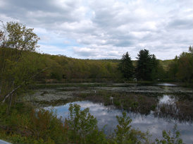 June, 2013 - The pilgrims landed in 1620, but it didn’t take long before wanderlust overcame the settlers. As early as 1634 and 1635, incursions were made into the lands of the Connecticut River and settlements began in Wethersfield, Windsor and Hartford. Soon after the conclusion of the Pequot War of 1637-8, additional small groups settled New Haven, Milford and Guilford. Farmington initiated its settlement about 1640. Other settlements were initiated away from navigable waters where the only transportation was by ox cart, horse or on foot which made communication between settlements far more difficult. Connecticut was untamed wilderness, a few minor roads, trails and broken paths and largely unexplored. John Steel, William Lewis and Samuel Steel recorded the first deed given by the Native Americans to land in 1657 for a portion of the Naugatuck Valley granting the right to mine black lead. Mr. Steele and his fellow explorers claimed to have located a fabulous lead mine. The infamous lead mine, to this day, has never been located and remains part of local mythology. Other deeds signed by Native Americans were recorded surrendering title to the lands that later made up the State of Connecticut.
A committee was appointed by the General Court to view a place for a new plantation in the Naugatuck Valley. In light of the favorable report received, application was made in the fall of 1673 by Thomas Bull, Nicholas Olmstead and Robert Webster requesting that lands might be granted for a plantation at Mattatuck. Additional lands were added in 1674. Articles of Association and Agreement were created to establish the rules for homesteaders. Some of the requirements for homesteaders included that each inhabitant would have 8 acres for a house lot, agree to pay all rates and taxes, build a house of at least 18 feet in length and 16 feet wide with a good chimney within four years of settling and remaining on the land. Allotments would be forfeited by anyone not meeting the committee’s requirements.
The allotments were not without complications. Eight acres for a home lot was not always as nice as it sounded. Much of the land was rocky and of moderate productiveness. The Great River, later knows as the Naugatuck** River, frequently flooded. Floods, and sickness related to flooded lands and standing water remained a constant source of danger. It had been assumed that the alluvial lands around the river would be good farmland, but the danger of flooding soon diminished that expectation. Still settlers came, stayed and formed the community of Waterbury and later various other settlements, including Plymouth, became their own communities.
Thomas Hancock is listed as the original owner of a “fine meadow” of about twelve to fifteen acres which included a small island where he eventually made his home. He was one of the first to sign the Mattatuck Articles but later nearly forfeited his rights to his Mattatuck land. His house was almost completely clapboarded but had no chimney. He was gone most of the time, presumably in pursuit of Miss Rachel Leonard, of Springfield. Miss Leonard keeps him waiting for three years before consenting to live at Mattatuck as Mrs. Hancock. Eventually the Hancock family did stay long enough to gain full title to the land which included building a home according to the requirements. Mr. Hancock’s full and title rights were restored in 1683. Although it wasn’t long before he left his homestead and fine meadows, possibly because wilderness life did not suit the Hancocks. Mr. Hancock became keeper of the prison in Hartford. Though his meadowlands changed hands many times, it still retains his name. To this day the exceptional meadowlands and brook he was granted by the Mattatuck Articles, retain his name.
Presently, Hancock Meadows have been transformed as part of a series of seven flood control reservoirs built by the US Army Corps of Engineers along the Naugatuck River Watershed. The US Army Corps of Engineers maintains five of the seven sites, two are maintained by CT Deep. Hancock Brook Lake has 721 acres of undeveloped public land set aside for flood control and open space, non-invasive recreation, such as fishing and hiking and as a natural area set-aside for wildlife habitat. It has 438 acres of woodlands, a 40 acre lake and over two miles of brooks and streams which make for excellent fishing. Assorted wildlife, waterfowl, non-game birds and mammals make their homes in this protected site. I do believe Mr. Hancock would be proud!
By Judith Giguere, Town Historian
*My thanks to the US Army Corps of Engineers for their assistance with this article.
** Notes: The name “Naugatuck” came from an Indian word, “Naukotunk” meaning one large tree which was formerly in the vicinity of Seymour. Early records use the spelling of “Hancox” and later, the spelling is used as “Hancock”, I have used the later for the sake of consistency.
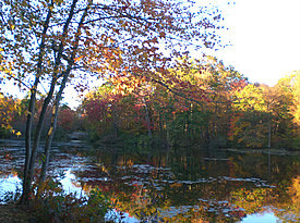 February, 2013 - What’s in a name? Can it tell what a place is known for, where a place is located or other definitive factors relating to a place? Early records relating to place names in Plymouth differ in the most intriguing ways. Many local areas were Indian names which were shortened or changed in order to suit the new settlers. For example, “Cochipianee” was later shortened to “Chippeny”, or “Chippen’s Hill”, reflecting title to the original owner of the land. Chief Cochipianee was of the Farmington area Tunxis Indians. Cochipianee may have been a member of the chief’s council as the “pianes” portion of his name reflects such status. Our friend, Chief Cochipianee had a great fondness for apple cider. He would spend many days gathering apples to bring to Farmington to be pressed at the mill. After his treasure was ready, he would roll the barrel to his home on Chippen’s Hill to be shared with his counterparts.
On the other hand, Poland Brook and Poland River had a much more complex origin. One early record shows a portion of land called, “Poole Land” named for land with water in the vicinity of the Plymouth/Harwinton town line. A 1721 map of New Cambridge, later Bristol, lists two Indians living in that area on land specifically set aside for their use. Their names were, “Poland” and “Bohemia.” It has also been suggested that the name Poland Brook was a reflection of the early Polish settlers who came to Plymouth and surrounding areas to work in the factories. This is inaccurate as the influx of immigration was not until the late 1880’s into the early 1920’s. Well past the time when Poland Brook was identified as such.
Another source calls the northerly section of Plymouth along Poland River, “Pole Land”. It is described as a major source of “hoop poles.” Hoop poles were made from various saplings and used in barrel making. Barrels were the most common early form of storage. Barrels did not break as easily as ceramic containers. The best hoops were made from hickory trees. These were used for apple, pork, vinegar, and beef storage. Oak hoops were used to strap packing boxes together for transportation. Mountain ash was used as strapping strips for butter tubs, sugar and flour barrels. Chestnut saplings were used to bind powder kegs. Possibly the reference to hoops came from the Indian long houses which existed in this area. Could the hoops or saplings have been used to create the curved framework of the long houses?
Fall Mountain is another interesting name. Some early sources state it was named for another Indian resident whose unpronounceable name was changed to “Fall” by the settlers. Another source uses “falls” in reference to any pond or lake. Indian Heaven adjoining Fall Mountain is recorded as a favorite Indian hunting area for its excellent source of game and its beautiful location, but could it be named “Heaven” for its high elevation?
Whatever the origin of the name, Plymouth is fortunate to have some of the most beautiful river land in the state! We will never know for sure the absolute truth of the name origins but it is fun to speculate!
By Judith Giguere, Town Historian
 November 2012 - Fledgling America may have triumphed in the Revolutionary War, but still had to prove her worthiness on the world stage. Great Britain and France continued in yet another war finding new and ingenious ways to harm each other and the brand-new American nation. America had yet to earn respect on the world stage.
James Madison was a short, scholarly, determined man, and one of the framers of the American Constitution; a man of character and our forth president. The English Orders in Council lead to an embargo and the Berlin and Milan Decrees of Napoleon put the new nation in harm’s way. Attempts had been made to get Great Britain and France to respect the trade rights of America to no avail. Both nations continued to impose trade restrictions on any nation consorting with the other, seizing ships, goods and sailors. Great Britain claimed the sailors were British citizens; therefore impressments were an acceptable method to return them to British ships. In reality, very few were really British citizens. On June 18, 1812, Madison and Congress declared war on Great Britain.
Angry New England threatened secession fearing loss of trade and economic disaster. New England blamed Madison for financial losses caused by “Mr. Madison’s War. The attempt of the Americans to annex Canada was a major failure. Yet the tiny American Navy serving on Lake Erie engaged the superior British Navy. An American ship, the Lawrence was under the command of Captain Oliver H. Perry. When Captain Perry’s ship was demolished by the British cannons, Perry and his remaining sailors abandoned the Lawrence and took a rowboat to another ship. Perry, from his rowboat, flagrantly displayed a banner to his remaining fleet, “Don’t Give Up The Ship.” The American Navy primarily privateers, manned by non-press gang crews proved formidable. Perry, using ships made from local trees and iron scavenged from barn doors successfully defeated the British squadron. Captain Perry sent General William Henry Harrison, who later became our ninth president, the much desired message, “We have met the enemy, and they are ours!”
August 1814, the British landed 6,000 troops in the Chesapeake Bay and headed toward Washington and “The Yankee Palace” as the British called the White House. Dolly Madison, the wife of President James Madison, is credited with saving the portrait of George Washington and other national treasures as the White House was evacuated from the ensuing British. The White House was decimated by British troops. The British Fleet headed for Fort McHenry where a vicious battle took place. Francis Scott Key, detained on a British ship, anxiously waited for dawn to see if the American flag on Fort McHenry still existed. The smoke and the bombs prevented any view of the flag, symbol of the new nation, until daylight. This battle inspired Mr. Key to write a poem entitled “The Star Spangled Banner” which was later set to music and became our national anthem. Andrew Jackson, our seventh president, won fame for his infamous successes when the British attempted to gain control of New Orleans and the Mississippi waterway. The war itself continued until February 1815 when the Treaty of Ghent was ratified by Congress. President Madison formally declared the war was over.
Nationally, the legend of American ingenuity was born. Unanticipated consequences of the War of 1812 were the stimulus of American industry, economic success, patriotism, good feelings and national pride. Goods previously imported were no longer available; therefore Americans prevented economic disaster by innovation. New industries were created. New establishments for the manufacture of cotton goods, woolen cloth, iron, glass, buttons, pottery and a multitude of new discoveries, and inventions grew from the prohibition of trade with the outside community. America again triumphed over the British and America took her place a world power.
Locally, Plymouth proudly claims these soldiers: Jedediah Alcott, Uriah Allen, Jonathan Andrew, Lyman Baldwin, Levi Brown, Leavitt Darrow, Benjamin Fenn, Lyman Jerome, Richard Mansfield, James Mix, Angus Nickelson, Harry Painter, Benjamin Palmer, Miles Smith, David D. and Apollos Warner.
By Judith Giguere, Town Historian
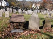
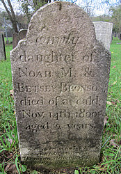 January, 2012 - The Old Burying Ground is located next to the First Congregational Church of Plymouth and Plymouth Green, all are listed on the National Register of Historic Places. Plymouth Green was created in 1747 of approximately four acres of land transferred through Caleb Humaston to the Society of Northbury by the Town of Waterbury to be used as a Parade and Burial Ground. The first recorded burial is Lettice Curtis. Mrs. Curtis was one of the many deaths from the Epidemic of 1749. It is believed that as many as 30 and possibly more deaths that were not recorded occurred that year in our fledgling community. The Old Plymouth Burying Ground contains approximately 600 markers and it is the final resting place of thirty-eight Plymouth Revolutionary War soldiers as well as three veterans of the French and Indian War, and two veterans of the War of 1812. It is the final resting place of many signers of Plymouth’s incorporation papers, judges, lawyers, doctors, ministers, wives, children and infants. Little Emily Bronson, daughter of Noah and Betsey is one of the
burials. Emily died tragically on November 14th, 1800 at age two. Sherman Bronson was born just a few weeks prior to Emily’s death. Shortly thereafter, Noah and Betsey, together with their remaining children gathered up what they could and walked to the Ohio territory where Noah and Betsey became a successful and respected farming family. Emily’s headstone, pictured above, includes a heart breaking inscription near the bottom which reads:
Father and My Mother
Tell my fate to my dear brother
Flaming elements of fire
Hath robbed you of your great desire.
Daniel Potter was a Connecticut soldier in the French and Indian War, instrumental in the settling of our new community and a signer of Plymouth’s incorporation papers.
Beneath this stone
Lies deacon Daniel
Potter who in a
Comfortable hope
Of one day rising
To a glorius immor
Tality fell asleepe
October 29, 1773
In the 55th year
Of his life.
Martha Potter
Wife of Daniel Potter
Having walked with God
Triumph’d over Death 13th
July 1770 ae 54 years
Mortals behold your fate
And lend a listening ear
Think on your final fate
For Christ will soon appear
Lake, the son of Daniel and Martha was born August 13, 1759 while Daniel was a soldier in the French and Indian War serving at Lake George. The child was named “Lake” in honor of this service. Lake George was named after King George III of England. England was falling out of favor with the thirteen colonies, therefore the child was named “Lake.” Daniel was an incorporator of the Town of Plymouth and representative to the state legislature several times. Lake Potter was a Plymouth soldier in the Revolutionary War.
Lucy Todd’s grave is presently unmarked. It is believed the original stone was made of gray schist and lost over the years, possibly discarded as an ordinary rock. Lucy was the daughter of Rev. Samuel & Mercy Todd. Rev Todd was the first minister to the Northbury community. Lucy was eleven months old when she died in 1752.
Amos Bronson, also interred in the Old Burying Ground, is referred to as “Dr. Bronson” in some sources; Mr. Bronson was a soldier in the French and Indian War serving in Captain Downs Company. Mr. Bronson died September 2, 1819 at age 88. He was one of the incorporators of the Town of Plymouth and the great-grandfather of Louisa May Alcott, celebrated author. Amos Bronson was also the grandfather of little Emily Bronson.
Tyler, Jerusha,
Ozias Tyler was an incorporator of the Town of Plymouth. This stone is near the entrance of the Old Burying Ground and has eroded considerably.
In Memory of
Mrs Jerusha
Consort to Mr.
Ozias Tyler
Who departed
April 8, 1790
Age 41
On what a moment of time
Hang Everlasting things.
In memory of
Mrs Freelove
Wife of Mr.
Asa Darrow
Who died with her
Daughter still
Born December 14th
1773 in her 24th
year
A small brown stone is in memory of three infant children of the Welton family. It speaks of the tragedy of infant mortality of early America.
In Memory of
3 children of Eli & Mrs
Anne Welton
Almon died
Nov 22d 1798
Ae 7 wks
Aaron Sanford died
Nov 29th 1808
Ae 1 year
Eunice died
April 21 1809
Ae 18 months
Eunice Warner
May 31, 1772 – Dec 15, 1839
Wife of
Eli Terry–
“Mother of all the Terrys”
Eunice Warner Terry was born May 31, 1772 and died December 15, 1839. Mrs. Terry was the first wife of noted clockmaker, Eli Terry. Eli and Eunice were married March 12, 1795. Eli and Eunice had nine children. The Terry family contributed to clock making industries and initiated other industries in the Terryville section of Plymouth. After the death of Eunice, Eli married the Widow Harriet Ann (Pond) Peck in 1840.
The Old Plymouth Burying Ground Restoration Project began in the fall of 2011. The project includes restoration of the grounds, signage, clean-up, and installation of period style fencing in the front of the cemetery with appropriate landscaping, grading and drainage. Volunteers are working on detailed transcription and photographing of the gravestones for preservation and for future generations. Tax deductible donations can be made to Plymouth Land Trust c/o Jerry Milne, 204 Keegan Road, Plymouth, CT 06782; please clearly state funds are intended for the “Old Plymouth Burying Ground Restoration.” Donations of $50 or more qualify for an engraved brick to be installed at the entrance to the Burying Ground for a lasting tribute. Engraved bricks have a maximum of three lines, sixteen spaces per line. Please indicate what you would like engraved with your donation by April 1, 2012.
Visitors are welcome to the site, to see the project and walk through the lives of our forefathers and Plymouth’s early history.
By Judith Giguere, Town Historian
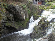 October, 2011 - Hoadleyville, the section of Plymouth once known as Ireland because of its largely Irish population, and later commonly referred to as Greystone is located near Hancock Dam. It is a hidden treasure of Plymouth. This section originated as part of Hancox meadows as the first arrivals passed through in search of the elusive lead mine. In 1700 the brothers Amos and Abraham Hickox established a sawmill. Later, circa 1750 Calvin Hoadley ran a Grist Mill and the Terry, Thomas and Hoadley Clock Factory found a home on Hancock Brook.
Eli Terry hired Silas Hoadley and the young Seth Thomas to help him build clocks. The three established the firm of Terry, Thomas and Hoadley. It was here Eli Terry fulfilled his famous Porter Contract for production of 4,000 clock movements—an incredible accomplishment in 1806! The three genius partners designed a system that used water power to run their machinery as well as standardization and interchangeable mechanical working of their clocks. Later, Eli Terry and Seth Thomas sold their interests to create their own companies.
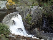 Silas Hoadley continued making clocks until 1849. He then rented his clock factory to Hancock Valley Manufacturing, which existed into the early 20th century. Silas Hoadley was elected to the State assembly three times and held a term as a Connecticut Senator. The pond and waterfall created for waterpower still exist in a beautiful setting on a dead end road near Hancock Dam. The pond is visible from the road, but the waterfall is on private property. Please do not trespass.
By Judith Giguere, Town Historian
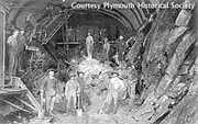 July, 2011 - In the early part of the last century, trains were one of the dominant modes of transportation and freight hauling. In the Plymouth area, the hills and steep grades made hauling heavy freight difficult even for trains. It was not uncommon to see two or three engines on a train pulling load and sometimes another engine at the end of the train to push. The decision was made to build a tunnel and correct the grade.
To fulfill the construction of the tunnel, it was necessary to cut through the rock ledges with the deepest, most difficult cuts at the southern end of South Eagle Street. Lowlands were filled to level the grade. The Pequabuck Tunnel, also known as the Mile Long Tunnel is slightly less than a mile at 3,850 feet with a width of 32 feet and height of 26 feet. Most of the construction was done by hand. Construction began in 1906 and was completed in 1910. The tunnel was built under the farm known as Sylvan Hill owned and operated by Charles Allen and family for whom Allen Street was named. Land was not purchased for the tunnel site, but instead, a right-of-way under the Allen farm and pond was acquired. The course of the Pequabuck River known as Devil’s Backbone was modified. Construction required no less than two hundred workers, most residing in small buildings along the site which were built for the use of the workers.
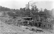 Construction temporarily stopped in the fall of 1907 due to the instability of the financial market. In July 1908, work had not yet resumed when a cave-in occurred at the tunnel site. The cave-in was caused by heavy rains compromising the loosened rocks at the top of the tunnel. The project engineer, assistant
superintendent and roadmaster as well as a special train of workers were immediately dispatched to the site to secure the tunnel.
The tunnel digging process created a large debris pile where one resident is reported to have discovered such mineralogical treasures as calcite, beryl, tourmaline, marcasite, azurite, malachite and even a few gem quality garnets. A substantial amount of Native American arrowheads and artifacts were also discovered at the dig site.
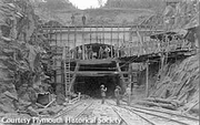 The first passenger train went from the new Terryville Station at Pequabuck through the tunnel on January 27, 1911 marking the opening of the tunnel for regular use. The new tunnel and improved grading, elimination of severe curves between Hartford and Waterbury shortened the time between stations and made travel much safer.
By Judith Giguere, Town Historian
October, 2010 - As summer winds down and autumn is imminent, it’s fun to see how much times have changed. Below are some interesting excerpts from the 1928 Plymouth Annual Report.
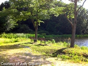 July 2010 - The sixteen acre pond was originally one of the holdings of the Eagle Lock Company of Terryville, but in the 1920’s the pond became the property of Walter Zeiner. It is located off Seymour Road on one side and Holt Street and Harwinton Avenue on the other.
In the late 1930’s, traumatic events in Europe were casting a foreboding shadow. The United States and the world were moving ever closer to the coming crisis of World War II. In the midst of the pending gloom, Zeiner’s Pond offered a safe place to leave the ominous news behind.
Summer days revolved Zeiner’s Pond. A series of cabins were once located on both sides of the lake. The shore was lined with grass, with a small beach area and large shade trees. Although the lake could become murky in August, it was a favorite summer haven for cabin renters and local residents. Small motor and row boats for fisherman, or just for fun, were commonly seen casually cruising the pond on summer days and sometimes at night for bullhead fishing. The pond was known for perch, bass and pickerel fishing. Swimmers enjoyed the quiet, bucolic setting.  Sun bathers would gather on the beach using an old-time mixture of vinegar and baby oil for suntan lotion. Summer evenings were also for first dates and romantic walks about the lake. The moon reflecting on the peaceful waters inspired many couples that later married. Today, Zeiner’s Pond is known as Lake Winfield. It offers trout fishing. Although not accessible for swimming; it still offers a beautiful setting. A lovely path encompasses the lake offering a pleasant walk about the lake. It has changed over the last century, but has not lost it charm.
By Judith Giguere, Town Historian
The Search Continues
By Judy Giguere, Plymouth Town Historian
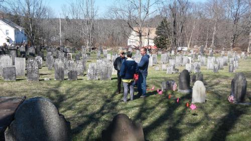
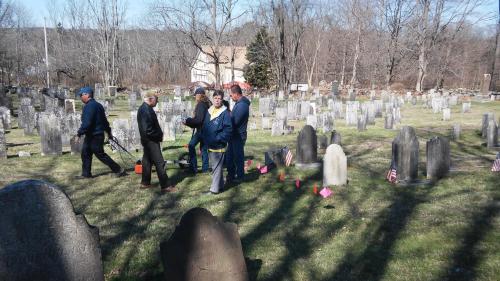
The latest research project undertaken to study the Old Plymouth Burying Ground was a ground penetrating radar study done by the combined efforts of the State of Connecticut Office of Archeology, Friends of State Archeologist (“FOSA”), and United States Department of Agriculture National Resources Conservation Service, the Plymouth Town Historian and CT Gravestone Network. All arrived at Plymouth Green on a beautiful morning and were directed to the cemetery behind the church. The determination was made to scan the oldest section, directly behind the First Congregational Church of Plymouth and over to the entranceway of the cemetery. Another survey could be done at a later date.
The early records of burials in the Old Plymouth Burying Ground have been lost for more than two centuries. A few death records exist, but not the locations of the actual graves. Therefore there is no way to know if gravestones are aligned appropriately or if the open spaces have been used.
Ground penetrating radar can be an excellent archeological tool as it is non-invasive. The actual unit looks like a strange lawn mower. It is dragged over the ground to detect below ground features, without actual digging or in any way causing physical changes to the site. The antenna transmits electromagnetic energy into the ground, which in turn, transmits signals back to the computer. The images that appear will show anomalies on the screen that will be interpreted back at the office.
Ground penetrating radar is never a perfect science. Many factors can influence the results. The soil type, texture, ability to drain water, clay soil, or organic matter- all can give deceptive radar readings or make it difficult to interpret the irregularities. The grave may have been backfilled with matter from other areas. Burial materials such as wooden coffins and shrouds decay quickly, leaving little to be reflected back in the readings. Ground penetrating radar marks breaks in the continuity of the natural soil. The breaks appear as unnatural and point to possible disturbance by humans. The area of the Old Plymouth Burying Ground, fortunately, has been relatively undisturbed by means other than burials. The soils are mostly a sandy mix which is well suited for radar.
History of the site plays an important place as well not just the mechanics of ground penetrating radar. Knowing the history and the traditions of the community gives important information. The old records on file define this site as an early Plymouth cemetery. Boundaries, according to land marks and deeds of this site are relatively unchanged. Historic documents state a major epidemic struck in 1740, shortly after the burying ground was opened. One third of the community was either disabled, dying, or deceased. Epidemics were common, medical science was in its evolutionary phase suggesting active use of the cemetery.
Social customs of the times generally considered marking of a grave as ostentatious. The person may also have been considered unimportant such as paupers, slaves or the indigent. At times, wooden markers may have been used which have long since rotten away. Local stones could have been used as grave markers or cairns of stones. Such markers are long gone because later generations were unaware of the importance or because the stones were an annoyance to lawn mowing. There are many reasons why the area would deceptively appear as open.
The ground penetrating radar of the old section is a window on early Plymouth. The multitude of burial images by the radar gives confirmation that the area was, in fact, actively used. This area can now be protected as ancient graves.
The Minister’s Legacy
By Judy Giguere
Plymouth Town Historian
Reverend Thomas (Thorsten) Alpine Carlson knew from his youth that the ministry was the right vocation for him even though he came from a family of adventurers. His parents emigrated from Norway and young Thomas was born July 9, 1865 in Alpine County California. His parents so loved the beautiful area that Thomas’s middle name was taken from the name of the county.
Carlson evenings were spent reliving the accomplishments of family members. Thomas’s grandfather was a ’49, panning for gold in the California Gold Rush. His Uncle Matt was a United States Marshall in Fairbanks, Alaska. Joetta, his wife, was descended from Welsh kings. Tales of Indian war parties, wagon trains, new states forming and of an ancestor of Joetta that was on General George Washington’s staff during the Revolutionary War were very familiar to young Thomas and shared with his own children as they grew up. Evans Fordyce Carlson, the first born of Thomas and Joetta’s four children wanted adventures of his own and to earn his place in family history.
When Thomas Alpine Carlson was a young man, his parents moved the family to a deeply religious Norwegian community in Wisconsin. The extended family taught Thomas strict religious tenants but it did not deter his faith, it increased it. In 1890 Thomas entered the San Francisco Theological Seminary. Later he transferred to Auburn, New York where theology was less severe. His first church was Sidney, New York but his parishioners were not satisfied with his gentler theology. He moved to a church in Middlebury, Vermont. While in Middlebury, the 1918 Influenza epidemic struck. Not only were his parishioners deeply affected, but his own family. Son Charles Dana Carlson, born January 25, 1899 and died in the epidemic. Evans had run away and joined the Army, daughter Karen was married and young Tom, Jr. was still at home. Joetta was frequently sick and Reverend Thomas‘s faith was shaken.
Reverend Thomas served at a church in Shoreham, Vermont near Lake Champlain. The world of the early part of the 20th century was changing fast. It was confusing. Rules of his generation seemed to have disappeared. He tried hard to work it out in solitude but with great difficulties within his own home he found it nearly impossible. He contracted typhoid and was very sick for several months. His faith would soon be restored in new religious books of the day. Slowly, he regained his momentum and he served at churches in Dracut, Massachusetts, Peacham and lastly to the First Congregational Church of Plymouth, Connecticut from 1926 to 1944.
He chose to retire in 1944, his personal strength fading. He had lost his wife, a son during the 1918 influenza epidemic, daughter Karen was far away with a family of her own and Evans was by this time, serving in the Marines. Reverend Thomas Alpine Carlson died April 14, 1953 in Plymouth and is buried beside his wife Joetta; son Thomas Olney Carlson and his wife, Reka in West Cemetery, Plymouth.
The Carlson’s first born son Evans was a man with a dream – which he fully intended to see to its fruition. He had joined the Army before he was old enough to enlist by lying about his age. His parents were notified and reluctantly gave permission for his enlistment. He served in the Philippines and Hawaii, discharged as a first sergeant. He enlisted again and served in the Mexican expedition. During World War I he was awarded the Purple Heart for wounds received in action. He became second lieutenant in 1917, made captain of field artillery, later serving in Germany with the Army of Occupation. He was discharged in 1921.
In between enlistments in the Army and the Army Reserves, Evans married his landlord’s daughter, Dorothy Secombe. The Secombe family were devout Christians which fit with Evans own strong faith that he learned from his minister father. Evans and Dorothy’s son, Evans C. Carlson was born October 1, 1917 in Cochise Arizona, later also serving in the Marines. The couple soon divorced and Evans, after his discharge from the Army was unsure of his direction. After working a variety of jobs, he went back to the military.
Evans, the minister’s son, inherited his father’s drive to follow his heart. This time he enlisted in the Marines as a private in 1922. He served in Quantico, Puerto Rico, the Pacific Fleet and Shanghai China. In 1930 he served in Nicaragua. Evans Fordyce Carlson continued to rise through the ranks. After returning to the Unites States, Captain Carlson served as executive officer of the Marine Corps Detachment at President Roosevelt’s alternative White House in Warm Springs, Georgia. He became friends with the President and his son, Jimmy. After Warm Springs, he served in Shanghai then China. He learned the Chinese Language, returning to Quantico and studied International Law and Politics. He posted again in 1937 as military adviser to the Chinese forces.
China had, for centuries, been a feudal society until the population rebelled and the government collapsed. Many rebellions followed with civil war to determine a form of government or follow a Communist model. Carlson had a unique opportunity to study China in its struggles and meet with its leaders: Deng Xiaoping, Zho Enlai and Mao Zedong. The Marines again promoted Evans, this time to the rank of major.
In early World War II, he was in command of the Second Marine Raider Battalion as a lieutenant colonel. His years in China and Asia gave him new ideas about military tactics. He proposed the creation of a unit that became known as “Carlson’s Raiders.” It was to be his greatest success yet. Evans Carlson, son of a small town minister, was about to completely change the entire thought process of Marine training!
Carlson, through his time spent overseas, learned that the units performed better when they were given conviction of their mission and to understand what they were fighting for. Each man was hand-picked and personally interviewed by Carlson or Jimmy Roosevelt. The nine man squad was changed to ten – three sets of three and a leader with heavy firepower. These were called “fire teams”. Training consisted of a fifty-mile hike every day, constant training, the rifle always at their side, including Lieutenant Colonel Carlson. Each man learned to assemble his rifle and take it apart – blindfolded. Evans also trained the unit to work together without fear or favor, envy or contempt. To this training, he added a phrase he learned in China, “Gung Ho” which meant “working together.”
The test of these new fire teams would be an assault on Makin Island, a small but strategically important Japanese occupied island in the Pacific Gilbert Islands. August 9, 1942 the teams boarded the U.S.S. Nautilus and the U.S.S. Argonaut and left Pearl Harbor for Makin Island. The plan was to land on Makin at night and do as much damage to the Japanese forces as possible.
Lieutenant Colonel Carlson’s Makin Island mission was a success. An enemy garrison of three hundred was destroyed, two small transports, two radio stations, two sea planes and a troop ship headed to Guadalcanal was sunk. If the troop transport had successfully made it to Guadalcanal, the fate of the battle for the Pacific might have been very different.
Lieutenant Colonel Carlson’s concept of the fire teams would become part of the Marine Corps methodology. Lieutenant Colonel Evans Carlson continued to distinguish himself during World War II. He was awarded numerous medals and commendations, achieving the rank of general, earning his place in Carlson family lore and American history. General Carlson died May 27, 1947 and was laid to rest in Arlington National Cemetery. General Carlson always spoke fondly of Plymouth, Connecticut and of all the places he served, he said his heart belonged to Plymouth.
Mr. Robinson’s Horse
By Judy Giguere,
Plymouth Town Historian
There was a time when milk was delivered by William Robinson’s milk cart and his horse ‘Dandy”. As more and more people moved from the farms to suburban areas for industrial employment, groceries were not necessarily raised on their own farms. Milk and various other grocery items were delivered.
Dandy was a calm, gentle horse mirroring Mr. Robinson’s own kindly demeanor. Mr. Robinson’s daughters, Faye, Margaret and Edith would occasionally ride Dandy or hitch him to a cart. The girls had a Shetland pony and two wheeled cart which they used to go to school but Dandy was always their favorite – except the day Margaret and Edith decided to take Dandy to town! It was the day the town’s first brand-new steam roller was in service and Dandy was not pleased with this motorized beast! He took one look at the fearsome mechanical terror and off he ran! The cart bounced precariously through town giving Margaret and Edith a ride they never forgot. Dandy finally stopped at one of the church yards. The girls were frightened but unharmed and missing their Sunday hats. Each girl the following Sunday arrived at church with new hats and a special prayer of thanks to have been delivered safely – including Dandy.
William Robinson’s farm was called Pleasant View Farm as it had an excellent view of the surrounding country. He and his wife, Maggie, were from Canada and married in 1890. He was well known in the community for his gentle manner, beautiful horses and willingness to help someone in need.
The daughters grew up and two married. Faye moved to Glen Head, Long Island to stay with her sister Edith after serving as a missionary in China for over twenty years. Faye died on August 31, 1948. Her sister, Margaret married Rupert Kittredge and Edith, the youngest, married Everett O. Leslie of Glen Head, Long Island.
The Robinson Farm was once known as the Griffin Place located about a mile or so from Terryville center. The street was called, “Robinson Road” now known as Harwinton Avenue.
The Holt District School
By Judy Giguere,
Plymouth Town Historian
Andrew Buell went to school in New Britain at the Normal School. For transportation, he rode his horse each day. When his father died in 1868, Andrew bought out the other heirs to the family home and land. He married Lorena Schofield in 1874 but Lorena died shortly thereafter leaving Andrew with a small son.In 1878, he married Jennie Merriman who had been a good friend of Lorena’s. At this time, in conjunction with his mother, sister and neighbors, he began farming.
Plans had been formulating to build a school house in the Holt District which encompassed the present day North Harwinton Avenue area. In 1880, Fowler Fenn and Lyman Baldwin were sent by community officials to investigate conditions at the North Street District School House which was located near the intersection of North Street and Sawmill Road. Was the school too far for students to travel? Was the school building suitable? In need of repair? Of sufficient size for the growing community? Should the district be combined into one school house instead of two? It was decided to begin preparations for construction of a new school house once a location was confirmed. Andrew Buell was contracted to cut logs for what would become the Holt District School House. The logs were drawn by oxen for cutting into boards at the sawmill on Minor’s Farm. In Spring, stone was gathered to be used for the foundation. Granite rocks weretaken from the woods east of the farms formerly owned by the Nelsons and Curtis families.
In November 1880, the final site was approved. Actual construction of the school building began in January 1881. Andrew Buell and Fowler Fenn completed the ditch for thefoundation. The location was just north of the farm owned by Hilo Holt, hence the name: Holt District. Mr. Buell taught a class of twenty students in the old North Street school house. The school year ended late in March as students were needed to help with farm work. Mr. Buell was paid $106.13 for the school year, the payment included supplying wood for the school house’s wood burning stove.
The school was completed and approved in June 6, 1881. The old building was sold to Hilo Holt for $14.50. October 1898 School Districts 12 and 13 were combined into one district to be served by the Holt School or North School as the new school was known. It was the last one room schoolhouse in Connecticut. It was closed by the State of Connecticut in 1957.
The Holt District School had a pitched roof, round attic windows, wood stove and two outhouses. The large boulder next to the school remained for the children’s amusement. After the school closed it was home to the High Riders Snowmobile Club and later sold. Eventually it became a private home with major changes but in its heart, it is still the old schoolhouse of Holt District.
Notes courtesy of Terryville Public Library Plymouth History Research Room.
Excerpt from the Diary of Mrs. Andrew Buell
Reminisces of Old Main Street
By Judy Giguere,
Plymouth Town Historian
Main Street in the early 20th century was lined with elm trees. The trees were so thick they created a tunnel of foliage on Main Street and other streets along it. The trees were planted to honor each of our Civil War soldiers. In the 1950’s, nearly a hundred years after planting, the Elm Blight claimed the trees. Maples were planted to replace the old elms but did not survive unfortunately due to the salting of the roads in winter. Only a few maples that were planted on other streets off Main still survive.
Main Street began at the Harwinton Avenue intersection and ran to the intersection of Route 6 and Route 72. The trolley ran along Main Street as well as the lower end toward Route 72 was well known for horse racing. A livery stable and hotel was at the intersection of Main Street and North Main Street. The livery and hotel owned by E. Grant Austin. Mr. Austin’s teams of horses were widely in demand for a variety of kinds of hauling.
The plaza where Adams IGA is now located was an empty lot with a stream and ice house. The ice house provided ice for the “ice boxes” a form of refrigeration before electricity. From Main Street the road that goes to the plaza is called “Elm Street” and leads to homes built for employees of the Eagle Lock Company in the years of 1910 to about 1920. The neighborhood was called, “Hillside Park.” Another street was called “Orchard Street” as it was part of the apple orchard owned by Eli Terry Jr. A few of the old apple trees still exist. The first gas station in Terryville was also located on Main Street. The gas station was the former repair shop of the Eagle Lock.
Terryville Congregational Church is a bit further east along Main Street. It was built in 1838 but was totally destroyed by a fire of unknown origin in 1967. A parsonage was built by Eli Terry next to the church. Behind the church and encompassing several acres was the Eagle Lock Company. At this point in history, the company had 1,800 employees. Many of the employees of the local industries saved their money for the construction of several churches and home building also soared! The new churches also provided for faith-based cemeteries for the faithful. Nearly 400 new homes were built by employees of the Eagle Lock and various other local industries. Terryville grew faster than Plymouth Center because of the availability of water power needed by industry. Pequabuck also had access to the railroad and water power. The industrial development is the reason the Town of Plymouth is divided into three postal zones, Plymouth, Terryville and Pequabuck.
Within the Eagle Lock complex, a small cemetery was located. Eli Terry and his second wife are buried there. The cemetery is surrounded by an iron fence made at the Andrew Terry Company located in Pequabuck. The Andrew Terry Company was one of the first malleable iron companies in the United States. Cooper Oven Thermometer was located near the Andrew Terry Company. Cooper Oven manufactured the first thermometers for cooking.
Present day Lock Museum was erected on the site of one of the offices of the Eagle Lock that was later converted to the municipal Town Hall. It is on Main Street at the base of Prospect Street. The building was renovated to set up town offices; a court, a jail and a large hall on the second floor. The hall was used for many events, dances, public meetings, plays, basketball games, church fairs and graduations. Across from the jail area was the court where many local cases were heard. An addition to the building was added for our fledgling fire department.
Many factors evolved to create the Town of Plymouth. As people left eastern Europe to come here for freedom and to work. Their tenacity built the town into a special place of divergent cultures, faiths and occupations. They initiated the growth as they were the ones that worked in the factories built by the creative initiative of those that opened the factories, stores, and variety of businesses to encompass the Town of Plymouth in the early 20th century. That vibrancy continues today.

 On March 25, 1774, the British closed the port of Boston in hopes of calming the unrest in Boston after the “Boston Tea Party”. Parliament expected the costs for damages from protests to be repaid. Closing the port, in reality, did nothing to quiet the revolutionary fervor. In fact, it was a catalyst to bind the colonists together to reject England’s demands. Voices for independence grew louder and louder. The Colonial Congress voted to have no further contact with England. Colonists gathered to support Boston’s beleaguered citizens. The call for donations went as far as South Carolina and communities collected clothing, and supplies for Boston. Calls to boycott English products went to all the colonies in protest.
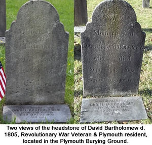
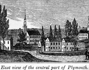
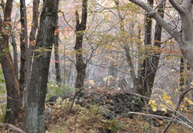 October, 2013 - The Witch of Fall Mountain claimed she could, in the dark of night, put a bridle on her aunt and ride her to meetings of the Witches Circle in Albany. At the same time, members of the community complained of invisible hands tormenting them with burning coals and hot needles. The Witch of Fall Mountain was blamed. The year was 1768 and the belief in unseen forces was still active and punishable. A few records state the witch was ordered to be tried by water. The theory, which dates back to ancient times, is the belief that if the water rejects the “witch” it is proof that the person is a witch. If the person sinks, they were innocent because the water accepted them. Hopefully the person was retrieved before it was too late.
 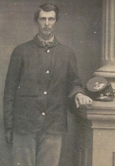 June, 2012 - Plymouth responded when President Lincoln called for soldiers. Plymouth’s population, in 1860 was only 3,244 including Thomaston, yet 283 served. One man in his 60’s dyed his hair and beard in order to look younger and enlist. Young men under eighteen would write the number “18” on a piece of paper and place it in their shoes so when asked, they could truthfully answer they were over 18!
 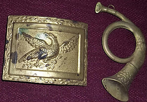 Augustus Hall Fenn enlisted as a private and left Camp Dutton as a First Lieutenant, yet received a discharge due to illness in 1861. It wasn’t long before he was recalled and commissioned as a major in the 8th Connecticut Volunteers and soon promoted again to Lieutenant Colonel. Augustus Hall Fenn was a participant in General Burnside’s expedition to North Carolina, participant in the capture of Roanoke Island and the Battle of Newberne. At Cedar Creek, he lost his right arm but refused to be mustered out. He served as a judge advocate several times and promoted again and again, finally to Colonel. Cornelius Wade Bull graduated from Yale in 1863; with the Civil War dominating life for both the Union and Confederate citizens, he gave up his studies and joined the U. S. Navy as a paymaster. His post was with the Mississippi Squadron. When the war ended, he returned to Yale to complete his studies in medicine.